RECENTLY I wrote an article for TCW about the increasing problem of flooded roads. Since then an example has occurred which shows how a lack of local knowledge and ignorance of the causes of flooding are contributing to the issue.
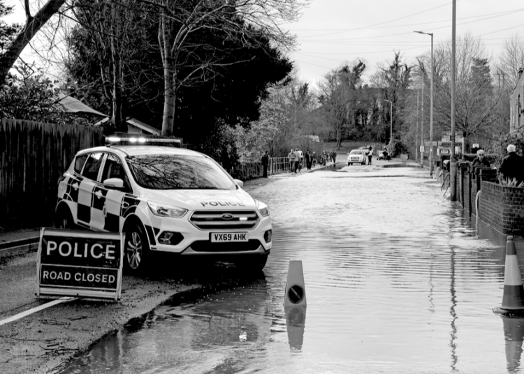
The A14 is a key cross-country road linking the Midlands and the North to the Haven Ports (Felixstowe and Harwich) and East Anglia in general. On February 28 it was announced that one carriageway of the road at Kentford, about five miles east of Newmarket, was blocked by flooding. the initial reaction from the Highways Agency was to pump the water away. Several hours later the pumping had not had a noticeable effect, and the road remained flooded over two lanes well into the next day, by which time larger pumps had been obtained. But where had the water come from? Although there has been frequent rain over the winter, it was not raining extensively when the flooding started and there was no river in the immediate vicinity that could be the source. The regional newspaper, the East Anglian Daily Times, quoted several local people, including the MP Matt Hancock who opined that ‘something should be done’. Nobody expressed the view that the source of the problem was rising groundwater. Having been associated with the location for much of my life, and having a basic understanding of the geology, I am surprised that nobody else had picked up this fact. Let me tell a story, and at the same time reflect on what it tells us about the ‘progress’ of recent years.
The A14 across Suffolk was constructed in the mid-1970s. This was a dry period, culminating in the drought of 1975-76, when groundwater levels would have been at their lowest. The site investigation for construction of the A14 would have entailed sinking of trial boreholes to measure the depth at which water was encountered, but they only give a snapshot in time. In the late 70s I noticed that a dip in a shallow cutting on the A14 around Kentford was often flooded. Eventually the Highways Agency installed pumps and improved roadside drains to remove water which encroached on the hard shoulder. I expect that the pumps have worked on a number of occasions over the intervening years, but conditions have been particularly wet over this winter, and perhaps they needed checking?
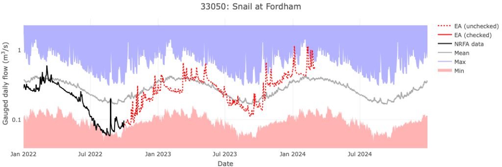
Storm Babet on October19-20 had a drastic effect on the rivers and groundwater of the area, as can be seen from the graph of river flow from the River Snail at Fordham, about five miles to the north.

Hydrograph at River Snail, Fordham, Cambs. (Source: National River Flow Archive, CEH Wallingford)
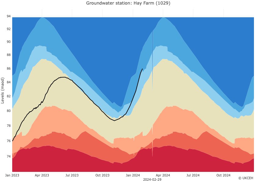
The frequent rain since has meant that flows have stayed high all winter. Throughout this period rain has greatly exceeded evaporation losses, and regional groundwater levels in the chalk which underlies the whole area have risen steadily. The chart below shows the past, present and predicted groundwater levels from an observation borehole near Royston, the nearest to this stretch of the A14.

Groundwater level at Hay Farm, Cambs. (Source: UK Water Resources Portal, CEH Wallingford)
Pumps would not make much of an impression on what is a reservoir of groundwater, and it is clear that groundwater level could continue to be high for at least another month. Rapid reaction of groundwater levels after prolonged rain are not uncommon, and have occurred with drastic results such as at Chichester after the wet winter of 2000-01 and Fring, North Norfolk, in December 1995, when the village became cut off by floods after a long drought.
Could anything have been done to prevent such an occurrence? Most probably not, but I certainly feel that the event could have been better anticipated and managed, certainly in that the authorities could have reacted in a more timely manner, and without the mystification. As a retired hydrologist and having worked in the area, I am slightly better informed than a member of the general public. However, the information I have illustrated is freely available on government websites, and should in theory be accessed by the concerned authorities. No doubt Mr Hancock would love to gain kudos from ‘doing something’, but he would not be able to put a mask on the floods and lock them up for months, as for covid.
I do feel that the dispersed nature of infrastructure management does not help with local awareness and capability. Fifty years ago there would have been a much more local focus for water and roads management, but now these matters are organised on a wider regional scale or sub-contracted out to independent operators. What is not required is a high-level investigation and hand-wringing by the media advocating the need for Net Zero and blaming climate change. Such events have happened before and no doubt will happen again: the problem is more about collective amnesia after a gap of 20 years.
Footnote: In the last few days there have been several developments. According to the East Anglian Daily Times (EADT), after initial flooding and closure, this stretch of the A14 has been subject to frequent lane-closures whilst pumping was carried out. Overnight on March 5-6 the road was completely closed for the Highways Agency to carry out work. The EADT reported on Thursday that ‘12 million gallons of water had been removed and new pipes installed’. On Wednesday groundwater flooding was reported in the City of Bury St Edmunds, and yesterday the Environment Agency website carried warnings/alerts of groundwater flooding on the A14 at Kentford and in Cambridge.

